
We’d heard stories and seen video clips about the tides and rocks along the western shore of the Bay of Fundy. However, seeing it exceeded all our expectations.
We walked along the “beach” at low tide and then returned six hours later to see how high tides really were (and this was during a neap or lower tide; as opposed to the spring or higher tides which occur during new and full moons).


They say a picture is worth a thousand words. So, rather than prattle on …


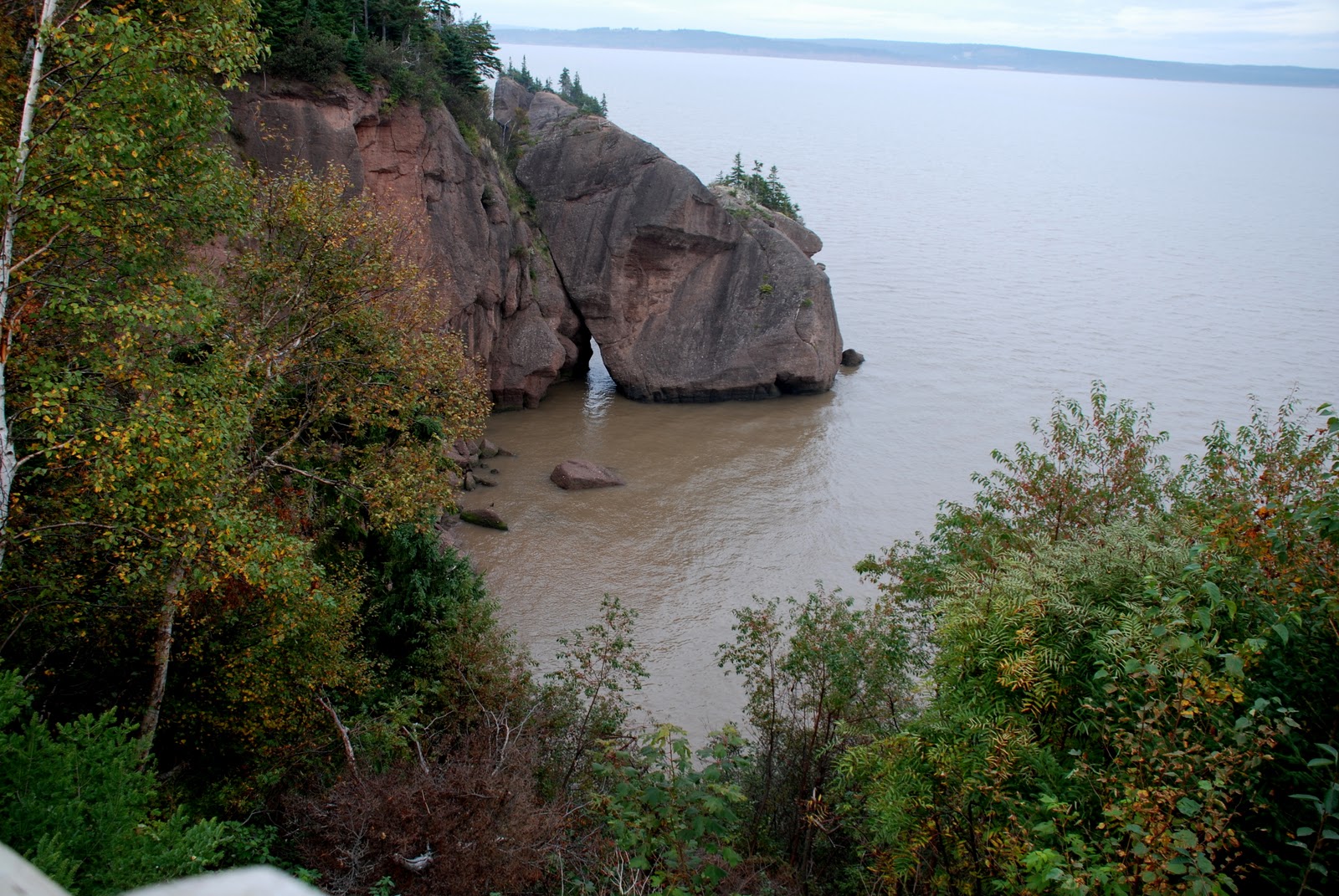
It is fascinating to examine the structure of the cliffs from which theses formations have been carved by wave action. It is basically a series of layers of gravel, mud and stones.

Because of the amount of mud in the shore’s soil by the billions of tons of water which ebbs and flows from the Bay of Fundy each day, the water has a distinctly brown color which, if left to sit for several hours turns nearly clear as the sediment precipitates out.

Between low and high tides, we took a side trip along some of the area’s back roads. We love these types of routes as it tends to give you a clearer perspective of the region and its people. We saw a number of old one room schools, long since closed …

many barns in various states of use and/or disrepair …


covered bridges …


lighthouses …

and even a cemetery dedicated to a former resident of the area …

No kidding!
